Knowledge of winds and currents was essential in maritime travel, but so was access to maritime technology. Sailors in the Indian Ocean world developed and utilized various maritime technologies beginning in the Pre-Modern Period. These technologies were largely unknown in Western Europe until the Early Modern Period.
Take notes on the different maritime technologies using the slideshow below.
Take notes on the different maritime technologies using the slideshow below.
Cartography
Cartography is the discipline dealing with the production and study of maps. Not surprisingly, in the Early Modern Period, cartography becomes very important in Europe.
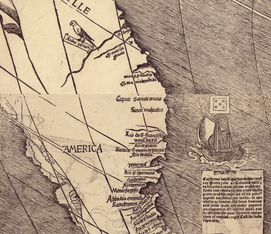
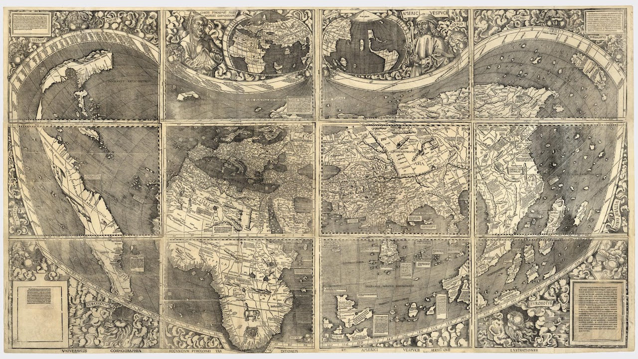
Martin Waldseemüller’s 1507 world map (seen here) was meant to document and update new geographic knowledge derived from the discoveries of the late fifteenth and the first years of the sixteenth centuries. Waldseemüller’s large world map was the most exciting product of that research effort and included data gathered during Amerigo Vespucci’s voyages of 1501–1502 to the New World. Waldseemüller christened the new lands “America” in recognition of Vespucci’s understanding that a new continent had been uncovered as a result of the voyages of Columbus and other explorers in the late fifteenth century. This is the first map that depicts the new world labeled as "America" (see detail below).
Waldseemüller’s map represented revolutionary new geography: it was the first map to depict clearly a separate Western Hemisphere, separated from Afro-Eurasia, with the Pacific as a separate ocean. The map represented a huge leap forward in knowledge, recognizing the newly found American continents and forever changing the European understanding of a world that was previously divided into only three parts—Africa, Europe, and Asia.