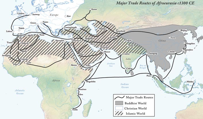
Each trade network web page begins with a map similar to the one above, detailing how each trade network connected the different regions of Afro-Eurasia. Notice the map above show certain cities that link together into a trade route. That's because most of the trans-regional trade occurred in large urban cities. Thanks to agricultural surplus and political stability, large, urban cities had increased specialized labor (like artisans and merchants), wealthy upper classes, and large markets. Usually, these cities were located in geographically "lucky" areas like Constantinople, the capital of the Byzantine Empire. Located at the far east of the Mediterranean, Constantinople is perfectly located at the center of all major trade networks. The Silk Routes and Trans-Saharan trade networks gave Constantinople access to luxury goods, or expensive merchandise sold in low quantities like silk and gold. In addition, Muslim merchants sail from the Indian Ocean to Mediterranean, carrying bulk goods, or items shipped in large quantities like spices and cotton. This made Constantinople a trade center in the Mediterranean, especially for Western Europeans who did not trade in the major trade networks.
The Silk Roads
|

Indian Ocean Trade Networks
|

Trans Saharan Trade
|
